Weather forecasting was critical for both Allied and Axis powers during WWII. Accurate weather data was essential for planning air and sea operations. The success of bombing campaigns against Germany and preparations for the Allied invasion of Europe in 1943 depended heavily on precise weather information. The acquisition and analysis of meteorological data became a matter of national secrecy due to its strategic importance.
Early Meteorological Flights
Meteorological reconnaissance flights around the UK coast began in 1940. By 1941, these operations were brought under the jurisdiction of Coastal Command. Initially, navigators on these flights were responsible for gathering weather information. However, the need for trained meteorological observers became apparent, leading to their integration into Met Flights starting in 1943.
Formation of Meteorological Squadrons
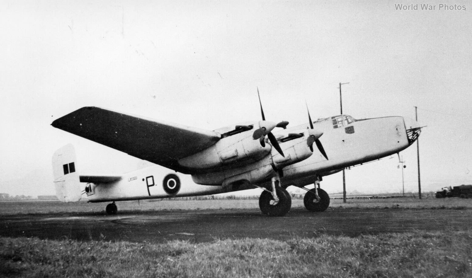
The Met Flights were originally numbered in the 1400 series. By 1943-44, several of these flights had grown large enough to be reconstituted as squadrons. For instance, No. 1404 Flight, Coastal Command, began using modified Halifax Mk V aircraft in December 1943. These modifications included:
- An additional station for the Meteorological Observer in the nose.
- Removal of the nose gun.
- Installation of an external probe (psychrometer) to measure outside air temperature and humidity.
- A special radio altimeter for calculating sea level pressures.
- Extra fuel tanks for extended range.
- Enhanced navigation equipment, including Loran for long-range fixes, Gee, ASV, and an American B3 drift meter.
In February 1944, No. 1404 Flight was redesignated as No. 517 (Met) Squadron and relocated to Brawdy in Pembrokeshire. The force expanded with:
- No. 518 Squadron at Tiree
- No. 519 Squadron at Wick (later Leuchars)
- No. 520 Squadron at Gibraltar
- No. 521 Squadron at Chivenor in Devon
Operational Details
Met Halifaxes from these squadrons flew predetermined routes with code names such as Bismuth, Mercer, Epicure, Recipe, and Magnum. Each route was flown twice in every 24-hour period, except for the aircraft based at Tiree, which flew four times in every 24-hour period. Flights were only halted in the most severe weather conditions.
Despite the risks, including engine fires and adverse weather, these vital sorties continued until the war’s end. The flights involved flying set patterns with positions on a 700 nautical mile track from base at 50 nautical mile intervals. At each interval, the aircraft would perform step climbs and descents to record pressure readings from sea level to 20,000 feet, transmitting the data back to base every half-hour.
Crews and Missions
Crews based at Tiree typically flew operations every four days and were granted ten days of leave every three months. These missions were crucial for maintaining the flow of accurate weather data, which significantly influenced the planning and execution of military operations throughout the war.
The establishment of dedicated meteorological reconnaissance squadrons and the regular collection of weather data played a pivotal role in the Allied war effort. The meticulous planning and execution of these flights ensured that crucial meteorological information was available to support strategic and tactical decisions, contributing to the success of numerous operations during WWII.
